SAN VACINTE CREEK |
 |
Project Name: San Vacinte Creek
Client/Project Owner: County of Santa Cruz, Public Works Department, USDA, Natural Resource Conservation Service, Salinas Field Office
Project Designer: Salix Applied Earthcare
Technique(s) Demonstrated: Rock Vane, Rootwad Revetment (habitat structures), Vegetated Riprap-Bent Pole Method, Live Staking, Live Brushlayering.
Geographical Location: The study site is located along 300 ft of San Vacinte Creek, a second-order stream in Santa Cruz County, near the city of Davenport, California. San Vacinte Creek has a 14.5 km (9 mile) long main stem and drains a watershed that encompasses approximately 1,820 hectares (4,500 acres).
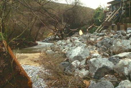
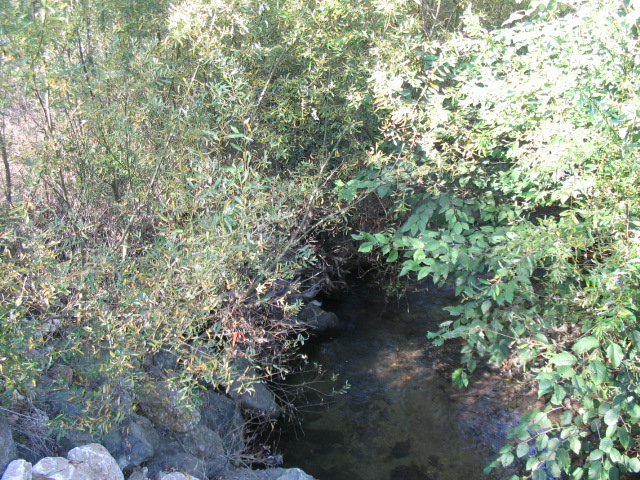
Geomorphic Setting: The primary purpose of the project was to stabilize the eroding streambank along the right bank of San Vacinte Creek. San Vacinte Creek is prime habitat for Coho salmon. A high angle turn in the creek was causing serious erosion and threatening the residential structures.
Performance Period: Phase 1: In 1998-99, vegetated riprap protection was installed along the project reach. Phase 2: In 2001, Rock Vane and Rootwad Revetment structures were designed and installed.
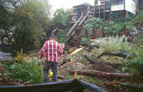
Project Description: This project was an Emergency Watershed Protection (EWP) project funded and initially designed by USDA, NRCS and administered by the County of Santa Cruz. Flood flows from large storms in the winter of 1996-1997 resulted in erosion of the streambank and threatened three residential structures located on the high right-descending bank. The flood flows also undermined an existing section of rock-filled gabion baskets protecting a commercial establishment located at the lower project reach. Historically, the San Vacinte Creek planform had been modified by the County Road and upstream residences. These alterations have resulted in a nearly 90 degree turn at the upstream end of the project reach.
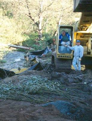
This project was completed in two phases. The project required environmental permits and approvals from California Department of Fish and Game and National Marine Fisheries (NMFS) because of the endangered species habitat (Coho salmon, steelhead, and red-legged frogs). NMFS and Fish and Game contended that the use of gabions and riprap results in long-term habitat degradation and required that the County of Santa Cruz consider bioengineering methods and include habitat enhancement and conservation measures for this project. The riprap design was modified to include willow pole planting, brushlayering and Rootwad habitat structures to incorporate habitat diversity, instream cover, pool habitat, and overhanging riparian vegetation. Because of difficulties in specifying and contracting, the County required the contractor to harvest, store and install the vegetative methods as directed by the bioengineering consultant. John McCullah, Salix Applied Earthcare was contracted to design and provide oversight on the project.
The purpose of the biotechnical work was to increase slope stability, provide habitat enhancements (cover, shade, carbon, insects etc.), and improve aesthetics. The willow poles and branches were harvested onsite. Some branches were installed immediately and others soaked in water prior to installation. The harvested willow poles had a diameter of 5 cm (2 in), and were 4 m (13 ft) long, and the branches were 2.5 cm (1 in) diameter and 2 m (6.5 ft) long.
Phase 1
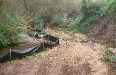
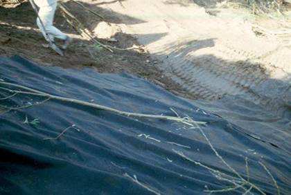
The riprap apron, designed by NRCS, was 4 m (12 ft) high and 1 m (3 ft) thick, and placed on a 1V:2H smooth graded slope. A 1-1.5 m (3-5 ft) deep toe trench, was excavated, and the entire structure was underlain with geotextile fabric.
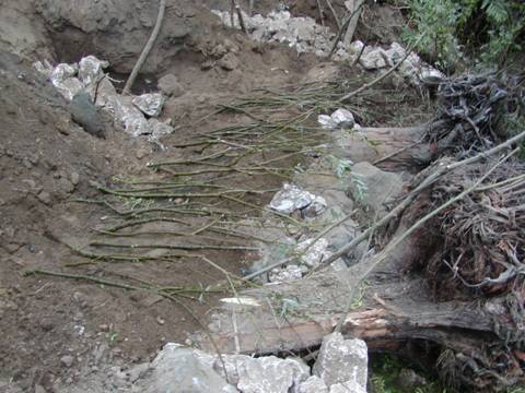
The modifications to the traditional riprap installation involved placing the live willow branches and willow poles in contact with the soil embankment. Maximizing soil contact along the branch was desired to increase establishment. First the fabric was placed on the 1V:2H slopes in preparation for the rock. Then slices were cut into the fabric beginning approximately 1 m (3 ft) above the mean low water level so willow poles could be inserted through the fabric. The willow poles were laid flat on the smooth graded embankment with the top part of the pole on top of the fabric, and the bottom part below. The basal ends of the poles were located below or near the perennial water table. The largest foundation rocks were placed in the toe trench and locked tightly together. Some willow poles and branches were placed in the trench with their tip protruding out over the stream. More rock was added to the structure and periodically the tops of the willow poles were bent up and out such that approximately 60 cm (24 in) of the terminal end was exposed to sunlight. Brushlayers were also installed such that the basal ends were stuck through the fabric into the embankment, the stems were dipping into the slope and the terminal buds stuck out over the creek.
Phase 2
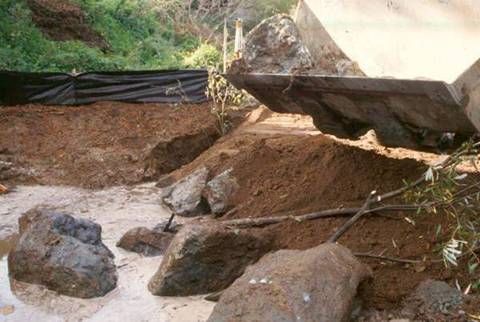
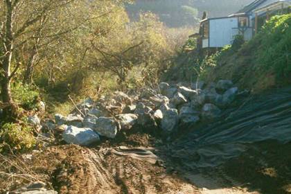
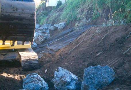
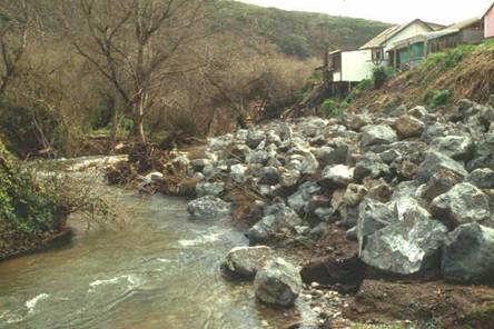
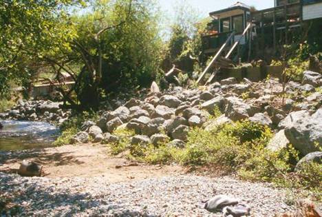
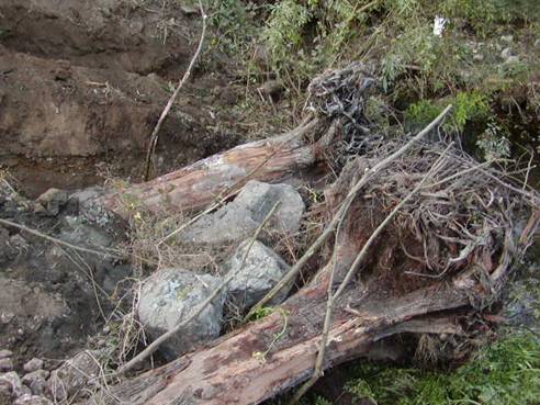
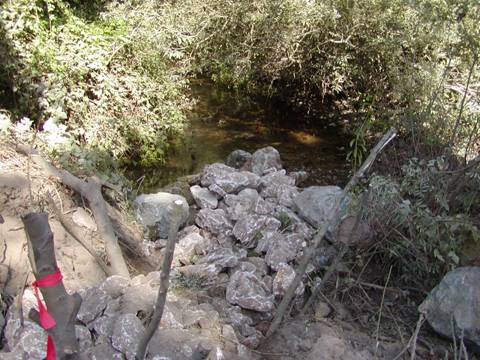
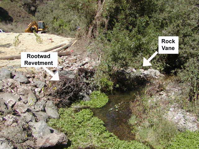
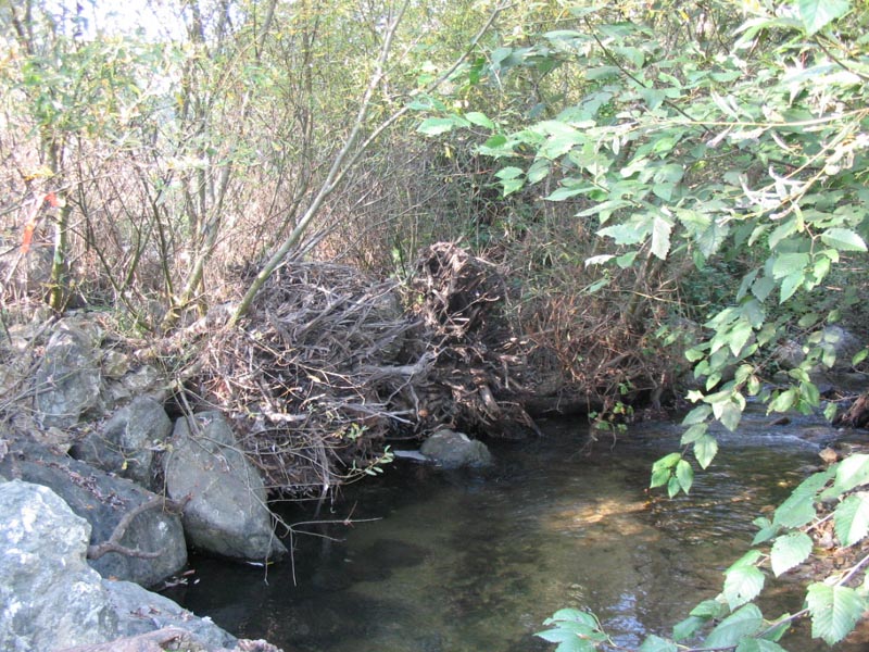
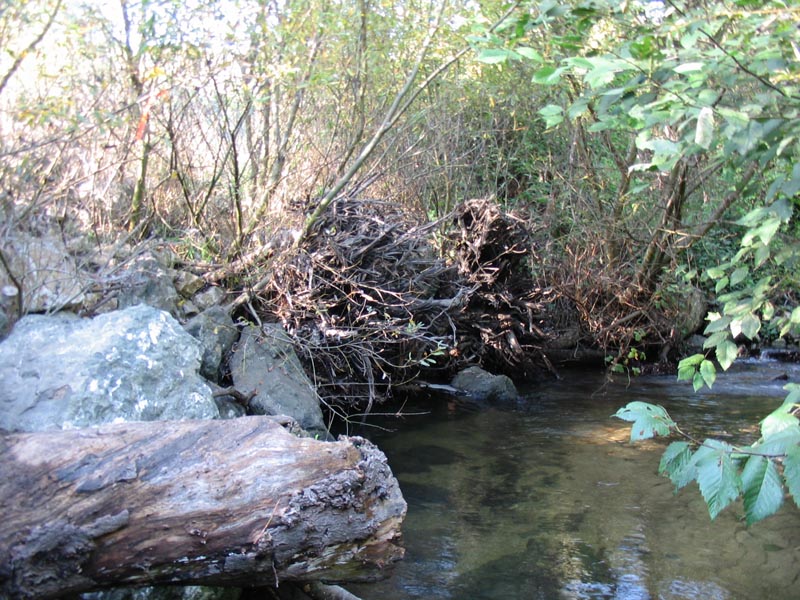
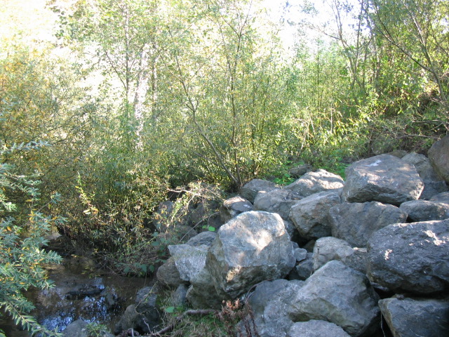
Two years later, signs of deterioration were detected in the vegetated riprap. The riprap was very large and keyed in deeply; therefore, it was believed that the riprap failure was caused by the severe flow angle. A rock vane was designed to re-direct the flow coming into the project reach. The vane was also intended to encourage sediment deposition upstream of the structure. Scour energy was redirected to the tip of the vane, creating a pool/riffle complex that is beneficial to aquatic organisms and Coho salmon. A rootwad revetment was also chosen to resist the flows on the outer bend while creating salmonid habitat under the overhang and in the scour pool. The rootwad revetment was made out of two footer logs, large boulders, and two rootwads. The two footer logs were 4.5 m (15 ft) long, and were placed parallel to the bank. Each rootwad had 3.7-4.3 m (12 to 14 ft) of bole (trunk) attached, and a 1.2 – 1.8 m (4 to 6 ft) diameter root mass.
All work was done from the top of the bank, as no sedimentation was allowed and, because of the sensitive habitat and possible presence of salmon, no excavation was allowed below the water elevation. The rock vane was constructed 12 m (40 ft) upstream of the critically eroded bank to deflect the angle of stream flow and alleviate the hydraulic forces that were eroding the streambank. Graded, poorly sorted (self-launching) stone was specified for the vane since excavation was not allowed as required by the permit. The permit allowed placement of boulders in the stream and on the existing substrate only. The use of self-launching stone and the upstream orientation of the vane facilitated the use of much smaller rock than the stone specified for the riprap. The stone D50 was approximately 30 cm (12 in). The vane was approximately 4.5 m (15 ft) long (approximately 1/3 of the stream width), and was angled 30 degrees upstream. The keyway was excavated into the bank 1.8 m (6 ft) and vegetated with pole plantings as it was backfilled with stone. First, three or four anchor stones, 60-90 cm (2-3 ft) in diameter, were placed directly on the stream bottom. Smaller stone was placed to shape the vane. The peaked crest was sloped at a grade of 1V:5H from the average high water elevation at the bank down to the channel bottom.
The rootwads were oriented such that the rootmass faced the flows, and the boles were placed into trenches dug into the bank. The trenches were dug just above water elevation, and dipped back into the bank so no sedimentation occurred. As they were backfilled with stone, the trenches were vegetated with pole plantings. The bank above the rootwads was brushlayered, and the bank was faced with self-launching stone.