JOHNSON CREEK

JOHNSON CREEK |
|
Project Name: Johnson Creek
Client/Project Owner: Oregon Department of Transportation (ODOT)
Project Designer: Robbin B. Sotir & Associates, Inc. (RBSA)
Technique(s) Demonstrated: Vegetated Mechanically Stabilized Earth (VMSE), Brush Mattress, Live Siltation
Geographical Location: Johnson Creek is located in a developed urban watershed in the Portland, Oregon metropolitan area. It is a third-order stream with a 100-year flood discharge of 142 m3/sec (5,000 cfs). The project was located on a 125 m (400 ft) long reach of Johnson Creek in the town of Milwaukee.
Geomorphic Setting: The Johnson Creek watershed drains a highly urbanized area with land uses ranging from heavy industry to low-density residential. Johnson Creek was widened during the 1930's for flood control purposes. A survey conducted at Johnson Creek prior to the start of this project indicated that the Creek was well established, with well vegetated, stable banks, excellent riparian habitat, and very low sediment production.
Performance Period: The project was constructed during the winter of 1993 and spring of 1994. Monitoring and evaluations were conducted for three years after construction was completed.
Project Description: The Oregon Department of Transportation (ODOT) realigned a section of Johnson Creek in order to widen a bridge and complete highway construction. The realignment shortened the creek by approximately 20%, thereby increasing its gradient. VMSE and Brushlayering were installed to protect the outer bank, and preserve the creek's water quality, fish and riparian habitat, channel stability, and aesthetics.
The initial ODOT design for the Johnson Creek realignment included a riprap armored channel, but after review by several groups a redesign of the channel by Robbin B. Sotir & Associates, Inc was selected for installation.
During construction, the channel cross-section was altered by lowering flood plain berms along the left descending bank, constructing a sub-channel that was sized to convey bankfull flows, and constructing a low-flow channel to concentrate flows during the summer months. A pool-riffle sequence was created by widening the sub-channel and raising the invert by 30 cm (12 in) in cross-over reaches and by lowering the invert by 30 cm (12 in) in outside meander sections.
A rock riprap toe was constructed to the ordinary high water elevation in the outside bends, and the banks above were stabilized with VMSE. Live siltation was installed along the inner bend (left bank) adjacent to the sub-channel to provide cover for waterfowl and overhanging cover for fish, while the upper left bank was protected with a brush mattress.
During the early spring, before the plants had become established, the site experienced a 50 m3/s (1,750 ft3/s) flood with mean velocities of 1.8 to 2.1 m/s (6 to 7 ft/s) and maximum velocities in excess of 3 m/s (10 ft/s). The soil bioengineering systems protected the bank, and by the end of the growing season they were providing excellent bank protection and habitat benefits.
Formal monitoring of the project for vegetation cover and species as well as bird and waterfowl species and activities continued through the winter of 1997. This project has experienced numerous floods with long duration flows, and continues to perform well and improve in environmental function each year.
2003 Site Visit: In April 2003, the principle investigator (J. McCullah) visited and evaluated the site with Oregon DOT Hydrologists. After almost 10 years the site was intact and the vegetation was very well established – so well established that access was limited. No bank erosion was observed and it was apparent that the reach had functioned properly through many flow regimes. The outer bend, protected with VMSE, had obviously experienced very high velocities, probably exceeding 5 to 6 m/s (16 to 20 ft/s). The flows observed at the time of the visit were less than bankfull or AHW, as determined by local indicators, and the velocities were estimated in excess of 3 m/s (10 ft/s).
The investigators did observe that the rock toe had eroded and the outer bank was undercut. ODOT hydrologists theorized that the extensive willow establishment may have actually increased local velocities and scour at the outer bend. However the undercut banks are a desirable environmental condition and it was agreed that, because of the riparian and vegetation condition, there was little chance of significant bank erosion even if the geogrid material degraded.
Evaluation: The design elevation for the ordinary high water appeared to have been underestimated by approximately 0.5 m (1.6 ft). The rock toe was therefore built too low. The geogrid and small cobble are the only structural materials left that are resisting the high tractive forces. Since the rock toe eroded it is a reasonable conclusion that the rock was undersized. It is unknown what the actual gradation was but the remaining riprap was angular, and appeared to be smaller than 0.5 m (1.6 ft) diameter.
The live siltation and brush mattress on the inner bend grew into a dense riparian forest. However, less vegetation on the left bank may have allowed more floodflow access to the floodplain at the inner bend and consequently taken some pressure off of the outer bend.
This case study was taken from:
Sotir, R.B. 1998. Retrofit opportunities for Urban Waters Using Soil Bioengineering. Wetlands Engineering & River Restoration Conference Denver, CO.
Photo Documentation:
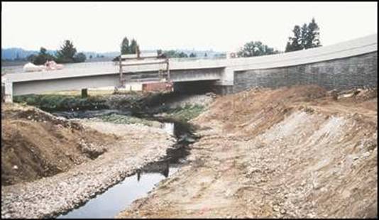
Project
during construction.
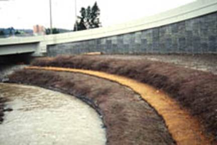
The
first winter after project completion.
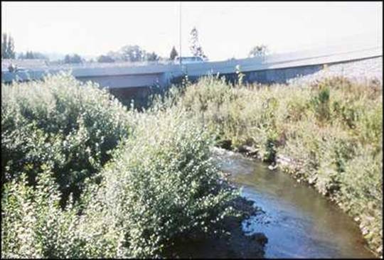
Johnson
Creek 4 years after construction.
 |
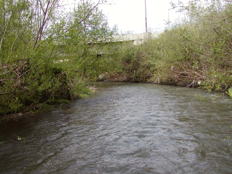 |
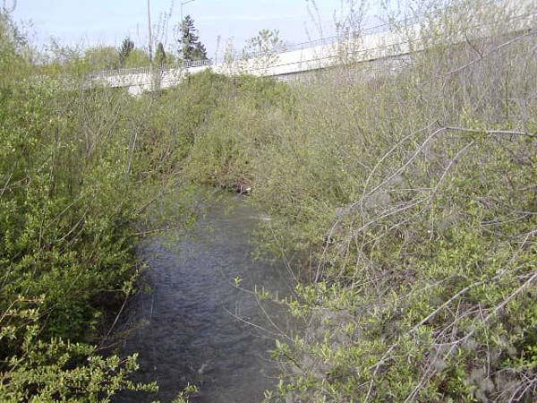
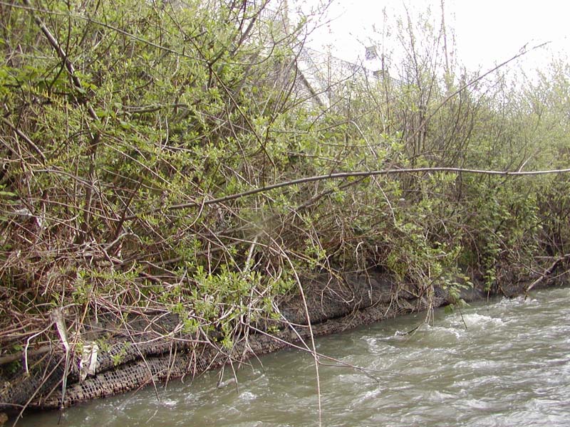
| Project reach in 2003, almost 10 years later. Shade, cover, and excellent riparian conditions predominate. | After 10 years the VMSE and brushlayering along the right bank is well vegetated. The live siltation and brush mattresses techniques installed along the left bank have been equally successful. |
 |
 |
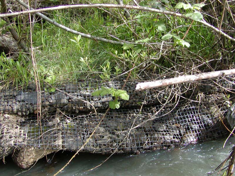
| In some locations the riprap toe below the VMSE (geogrid) has eroded
resulting in an undercut bank. This condition is indicative of the high
velocities that VMSE can withstand and the durability of the geogrid material. |
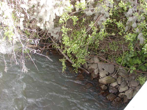
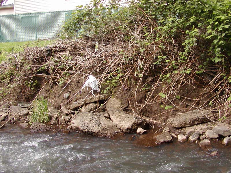
At the upstream end of the right bank the riprap is still in place.
The rock as shown here less than 0.5 m diameter and may have been undersized
for the project. |
 |
 |
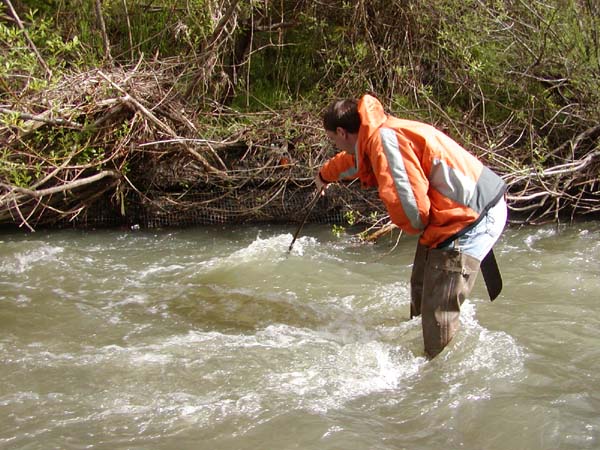
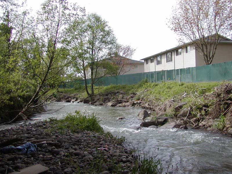
| The VMSE protection behaved like a typical resistive
technique, the result is a continuous, high velocity scour trench along
the toe of the outer bend. Velocity was estimated greater than 3m/s. |
Note the line below which the woody perennial shrubs will not grow.
The lack of perennial vegetation is one possible indicator of bankfull
stage or AHW. |
 |
 |
| Bank erosion immediately below the project was moderate to severe again
indicating the actual and relative success. |
Bank repairs downstream consisted of typical
rock and riprap and armoring. Very little riparian cover exists. April
2003. |