| VEGETATED FLOODWAYS |
 |
| VEGETATED FLOODWAYS |
|
1. CATEGORY
1.0 – River Training
2. DESIGN STATUS
Level II
3. ALSO KNOWN AS
High flow channels, bypasses.
4. DESCRIPTION
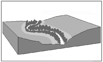
Zones within or adjacent to stream corridors may be protected from flooding using a variety of structural approaches. Confining floodwaters to a broad floodway bordered by levees or topographic highs is particularly attractive because the portion of the floodway not normally inundated can support vegetation and thus provide wildlife habitat or recreational opportunities. Floodways may be created by constructing levees, floodwalls, or by excavation. Excavation can consist of creating terraces or benches along an existing channel or a completely new flood channel (bypass). Roadway embankments sometimes serve a dual purpose by defining a floodway. Floodways may encompass the main channel of the stream or depart entirely from it and cross the floodplain as an independent channel (USDA, 2001). Vegetated floodways serve as a zone for riparian vegetation restoration of natural systems that have been disturbed by the construction or installation of flood control structures.
5. PURPOSE
Floodways do not directly address any streambank erosion process. However, they may reduce the potential for bed and bank erosion by reducing the discharge carried by the stream channel during significant storm events. Thus main channel depths and velocities and attendant shear stresses may be reduced, leading to reduced erosion. Floodways can create opportunities for increased water capture and storage within the soil profile adjacent to streams, thus increasing the longevity of base flows. When vegetated, floodways provide important terrestrial habitat and aesthetic value between flood control structures and the stream channel. In some situations, vegetated floodways will cause sediment particles to drop out, thus improving water quality and providing additional growing medium and nutrients for promoting vegetation establishment.
6. PLANNING
Useful for Erosion Processes:
Toe erosion with upper bank failure Scour of middle and upper banks by currents Local scour Erosion of local lenses or layers of noncohesive sediment Erosion by overbank runoff General bed degradation Headcutting Piping Erosion by navigation waves Erosion by wind waves Erosion by ice and debris gouging General bank instability or susceptibility to mass slope failure
Spatial Application:
Instream Toe Midbank Top of Bank
Hydrologic / Geomorphic Setting
Resistive Redirective Continuous Discontinuous Outer Bend Inner Bend Incision Lateral Migration Aggradation Conditions Where Practice Applies:
Vegetated floodways are used in zones where protection from inundation is required. This practice only applies to areas that have the space to install flood control structures and the amount of land required between the structures and the stream for vegetation establishment. The space required is dictated by the objectives of the project.
Complexity:
Moderate to High depending upon the size, scope, and classification of the installation.
Design Guidelines / Typical Drawings:
Floodway designs should include consideration of the effects of future development in the contributing watershed that will increase peak flows.Key design issues are reviewed by Nunnally and Shields (1985) and Corps of Engineers (1989). Floodways that are inundated too frequently or that intercept shallow groundwater tables may be too wet to support the desired vegetation or land use. The frequency of flooding for the floodway is controlled by the elevation of the bed relative to the main channel bed. However, in some cases weirs or gated control structures may be used to control the division of flow between a bypass and the main channel. Grade controls are often required at one end of the bypass to prevent bed erosion that would result in the entire stream being captured by the (often) steeper, shorter floodway or bypass. Estimating the effects of natural vegetation on channel conveyance is difficult (see special topics section on management of channel conveyance), and estimating the effects of vegetation on the rate of sediment deposition is fraught with uncertainty. See Riley (2001) for a case study. Maintenance plans and funding must be flexible to allow for uncertainty. USDA (2001) presents a classification system for floodways:
1. Class I - These floodways are constructed on sites where failure may cause loss of life or serious damage to homes, commercial buildings, public utilities, high value crops, and other similar improvements.
2. Class II - These floodways are constructed in highly developed and productive agriculture areas where failure may damage a few isolated homes, highways, minor railroads, or cause interruption of relatively important public utilities.
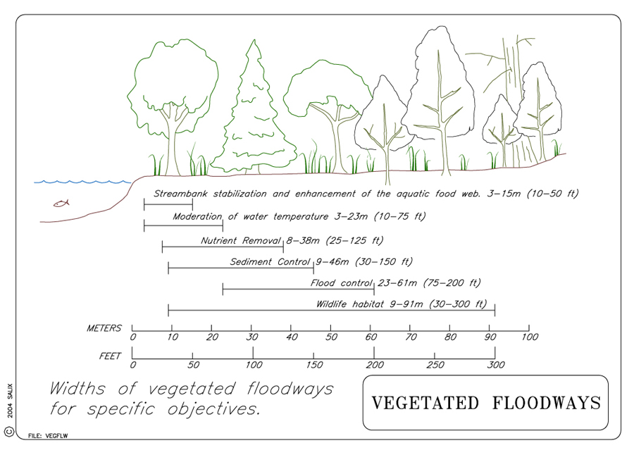
3. Class III - These floodways are constructed in rural or agriculture areas where damage from failure of the floodway or dike would be minimal.The objectives for installing a vegetated floodway dictate the design, space requirements, and required materials needed for a specific project. For example, proper species selection is critical and will vary depending upon the constraints and desired outcome for a project (USACE, 1989). A vegetated floodway designed for wildlife habitat and aesthetic improvement will require a diversity of species with areas of dense vegetation and a large total area of floodway. In zones where recreation opportunities are required, accessibility and usability will be a priority calling for less dense vegetation, while maintaining aesthetic values. In floodways where the primary objective is maximum capacity, the project designer may be limited to selecting only low growing grasses and legumes that can be mowed on a regular basis.
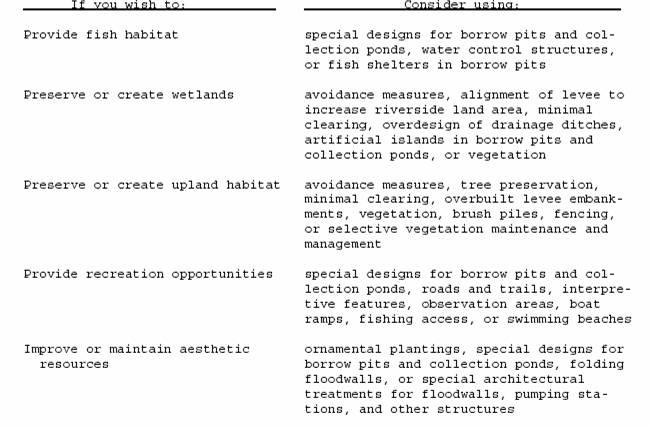
The location and width of zones of specific vegetation types and tolerance levels (to inundation as well as drought) across a floodway are an important consideration for proper species selection. The species of vegetation most tolerant of inundation should be installed closer to the stream and those most drought resistant closer to the levee or other flood control structure. Other measures and features can be included in the design to provide particular habitat and ecological benefits (see Table 1). Species must be adapted to local soil and climate conditions, and should take little effort to establish and maintain. Species should be selected that: have the ability to emerge though several inches of sediment; have the means to resume growth from buried stem nodes; have a rhizomatous or stoloniferous growth habit; and have stems that remain intact and upright year round. Plants that demonstrate the characteristics of an invasive species should be avoided (NRCS, 2003).
TABLE 1. Environmental features for levees and floodwalls
(USAEC, 1989).
7. ENVIRONMENTAL CONSIDERATIONS / BENEFITS
Naturally vegetated riparian habitats have experienced rapid decline throughout
much of the United States. Vegetated floodways may be used to preserve some
of this increasingly scarce habitat. Natural vegetation and wetlands adjacent
to or within stream corridors provide links between larger blocks of habitat
in a developed landscape, and usually exhibit higher levels of animal species
richness than equivalent non-riparian areas. Floodways can provide additional
benefits by serving as velocity regugia and sediment sinks. Other contaminants
may be processed within floodways, depending on residence times and other
site-specific factors. If conveyance issues (see special topics section on
management of channel conveyance) prohibit allowing natural woody or herbaceous
growth in the floodway, grassy areas there are useful for recreation (parks,
trails, playing fields, golf courses, etc.) if sufficient attention is paid
to floodproofing and clean up after flood events. Since floodways provide
overbank storage for floodwaters, downstream peak discharges may be reduced.
8. HYDRAULIC LOADING
Allowable shear stress for vegetated floodways is about 20 N/m2 (Schiechtl
and Stern, 1997).
After 3-4 seasons with successful establishment and survival, this number may
increase.
9. COMBINATION OPPORTUNITIES
Meander preservation, oxbow lakes, wildlife management, public access, wildlife
viewing, recreational trails and other recreational features.
10. ADVANTAGES
If the natural channel is unaltered and some riparian habitat is preserved
or restored between flood control structures, levees can have less adverse
effects on habitats than other types of channel modifications (USAEC, 1989).
Vegetation helps to decrease erosion by slowing velocities, and has beneficial
effects on channel substrate by increasing infiltration, which may increase
water storage during flood events. Slow release of water from the floodways
will reduce peak flows while maintaining or extending base flows, especially
within intermittent streams. Vegetation on floodways may provide pollutant
interception by causing sediment deposition and partaking in nutrient uptake
from floodwaters. Vegetation on a level floodway is relatively easy to install
and maintain due to the lack of severe slopes and the access to water normally
associated with wetland or floodplain areas.
11. LIMITATIONS
A diverse population of woody and herbaceous vegetation is beneficial for
habitat and aesthetic value however it has the potential to inhibit channel
conveyance. Floodway design must account for the presence of vegetation to
accurately predict the effects of vegetation on flood stage elevations.
Vegetated floodways usually require more land area than conventional channelized streams and may not be suitable for urban projects restricted by existing structures.
Species of vegetation selected for establishment must be able to tolerate inundation and drought conditions. This may cause the plan for re-vegetation to be quite complex. Different species may be needed for different zones of the floodway, prompting a need for varied seed mixes and container plants, and possibly multiple maintenance regimes.
12. MATERIALS AND EQUIPMENT
The materials and equipment required depend upon the scope of the project.
The standard excavators and bulldozers needed for earthwork will be required
for the construction of levees and other embankments. Weir and gate materials
may be needed for controlling and directing flow.
Establishing vegetation will require equipment such as a hydroseeder, a compost or straw blower, and a pump for irrigation purposes if needed. Planting materials may include seed, mulch, tackifier, fertilizer, compost, container plants and/or woody cuttings. See Vegetation Alone and Special Topic: Harvest and Handling of Woody Cuttings.
13. CONSTRUCTION / INSTALLATION
Standard flood control structures will be installed as designed by the project
engineer. Prior to excavation and earth moving, the topsoil or "duff" should
be scraped off the surface and stockpiled. This will conserve the microbial
organisms and organic matter to serve as a healthy growing medium for plant
establishment. The site should be examined prior to starting work to determine
if the topsoil will be filled with seed from exotic, invasive species that
may impede establishment efforts later on. See Vegetation
Alone for further
information. For stabilization of the soil surface prior to complete establishment,
an erosion control blanket may be installed prior to planting (see Turf
Reinforcement Mats for projects with floodways subject to high velocities).
14. COST
Costs for vegetated floodways are heavily dependent on site-specific factors such as topography, geology, and existing land use. Key cost factors include real estate, relocation, excavation and fill, and costs for grade control and diversion structures.
15. MAINTENANCE / MONITORING
Normal structural inspections are required for levees and other flood control
structures. Vegetation establishment and survival should be monitored and follow-up
planting may be required to replace plants that did not survive the initial
planting. Plants may need irrigation initially but should not require continuous
irrigation once established.
Monitoring should be conducted monthly during the first full growing season after installation, and can be reduced to annual visits in years following (Washington State, 2003). Survival of installed plants may be monitored by a numerical count, but as cover density increases it may be necessary to use percent cover as an indicator of plant health and survival.
In areas where maximum capacity or aesthetics and recreation are a priority, pruning, mowing, and weed abatement programs may be necessary.
16. COMMON REASONS / CIRCUMSTANCES FOR FAILURE
Flood control structures are subject to damage by flood flows, especially
when designs do not account for increases in runoff from further development
within the contributing watershed. Structural faults may lead to failure of
flood control structures, but extensive information exists for proper design
and installation.
Many factors can contribute to or cause failure of plants to establish,
thrive, and survive. Inadequate soil moisture such as drought or prolonged
inundation, insufficient soil nutrients, toxic soil conditions (high alkalinity
or acidity), and inadequate light are all soil and site conditions that
can influence plant health. Other common causes of failure include incorrect
planting locations, inability of plant material to reach the summer water
table, damage by wildlife and livestock, excessive pedestrian traffic,
and inability of installed plants to compete with naturally establishing
riparian vegetation.
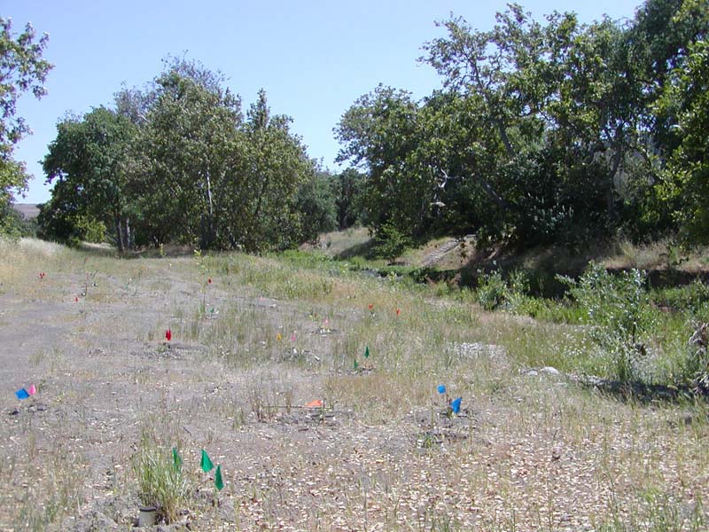
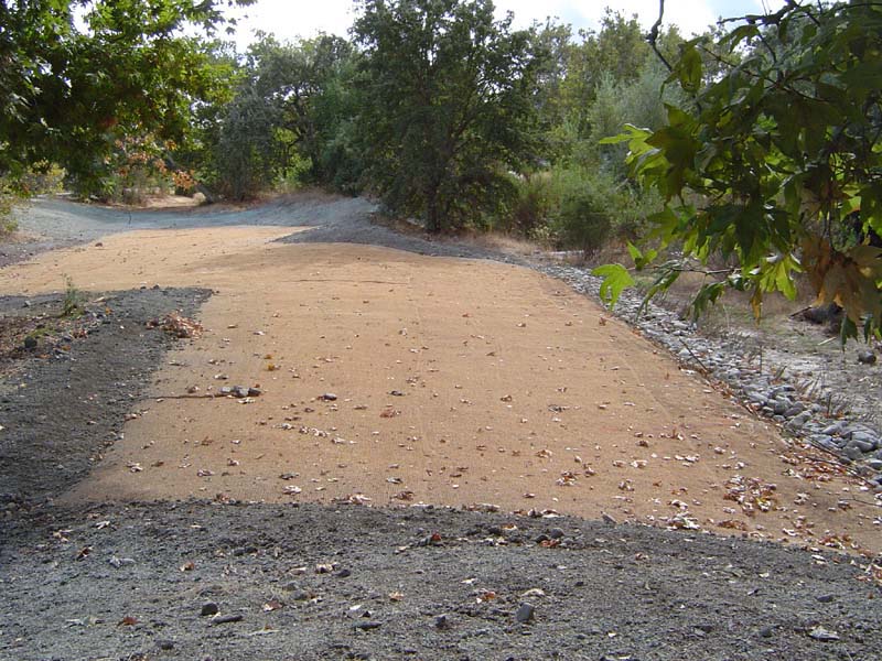
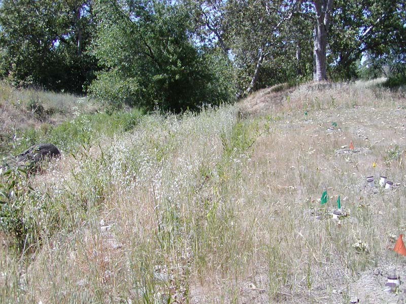
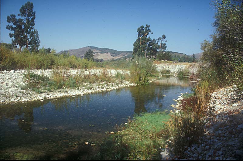
17. CASE STUDIES AND EXAMPLES
 |
 |
|
|
 |
 |
|
|
 |
 |
|
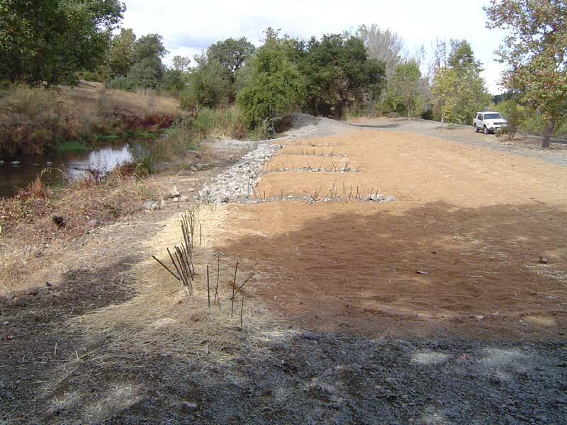
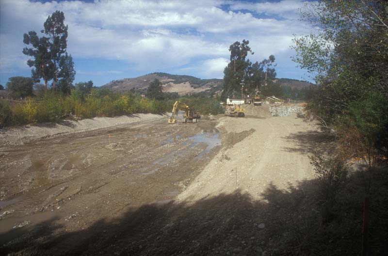
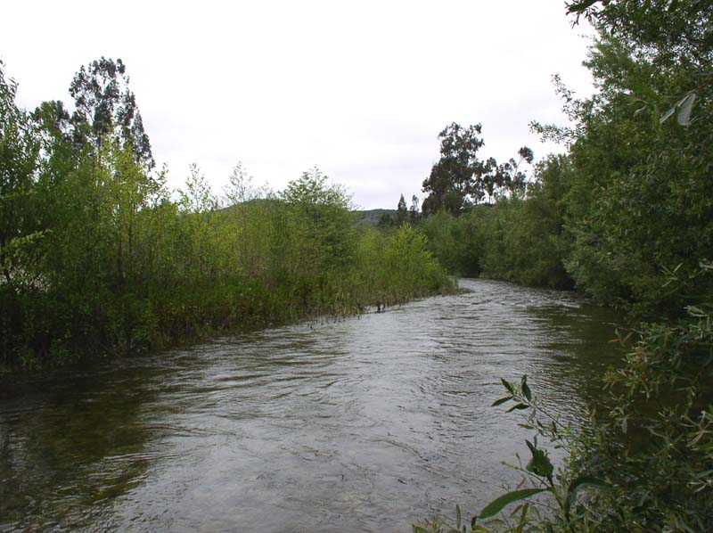
A project was initiated
to widen the channel and create an armored and vegetated floodway.
Photo courtesy of MPWMD. |
 |
|
|
|
Please visit the Photo Gallery for pictures.
18. RESEARCH OPPORTUNITIES
Although large amounts of data exist for what are known as "riparian
buffer strips", additional data regarding the abilities of vegetation
to cause sediment drop-out would be beneficial for determining the direct
water quality benefits of establishing vegetation specifically within a
floodplain.
19. REFERENCES
NRCS, 2003. Vegetative Barriers Code #601. National Handbook of Conservation Practices. Natural Resources Conservation District Conservation Practice Standards.
Nunnally, N. R. & Shields, F. D., Jr. (1985). Incorporation of
environmental features in flood control channel projects. (Technical
Report E-85-3), U. S. Army Engineer Waterways Experiment Station, Vicksburg,
MS.
Riley, A. L. (2001). Wildcat Creek: A Case Study in Adaptive
Management. Proceedings, Riparian Habitat and Floodplains Conference,
2001
Schiechtl,
H. M. & Stern, R. (1996). Water Bioengineering
Techniques for Watercourse Bank and Shoreline Protection. Blackwell
Science, Inc. 224 pp. Table
2.3, p. 19.
USACE. (1989). Environmental engineering for local flood control
channels. Engineer Manual 1110-2-1205, Headquarters, U.
S. Army Corps of Engineers, Washington, D.C. (pdf)
U. S. Department of Agriculture. (2001). Floodway. USDA Natural Resources
Conservation Service Practice Code 404. Washington, D.C. (pdf)
Washington Dept of Fish & Wildlife (2003). Integrated Streambank
Protection Guidelines, published in co-operation with Washington
Dept. of Transportation and Washington Dept. of Ecology, June 2003. (Chapter
6 pdf) (Appendix
L pdf) (Appendix
H pdf) http://www.wa.gov/wdfw/hab/ahg/ispgdoc.htm (April
2003)