BRANCIFORTE CREEK

BRANCIFORTE CREEK |
|
Project Name: Branciforte Creek
Client/Project Owner: County of Santa Cruz, Public Works Department; USDA, Natural Resource Conservation Service, Salinas Field Office
Project Designer: Salix Applied Earthcare
Technique(s) Demonstrated: Vegetated Riprap with Pole Planting and Brushlayering, Vegetated Gabion Baskets, and Vegetated Mechanically Stabilized Earth.
Geographical Location: The study site is located along an outer bend of Branciforte Creek, in Santa Cruz County, California. Branciforte Creek is located within the San Lorenzo watershed and is a tributary to the San Lorenzo River.
Geomorphic Setting: The primary purpose of the project was to stabilize the eroding streambank along an outer bend of Branciforte Creek, where a small radius bend in the creek was causing serious erosion and threatening a residential structure. Also of note is that Branciforte Creek is prime Coho salmon habitat.
Performance Period: Phase 1: Between January and March of 2000, vegetated riprap and vegetated gabions were installed along the project reach. Phase 2: In June of 2000, vegetated gabions and brush layering with soil wrap were installed above the Phase 1 installation.
Project Description: This project was an Emergency Watershed Protection (EWP) project, funded and initially designed by USDA, NRCS, and administered by the County of Santa Cruz . High flows during large storms events resulted in erosion of a streambank located on the downstream end of a low radius bend with highly erodible soil. The erosion threatened a residential structure located on the high right-descending bank.
National Marine Fisheries Service and the California Department of Fish and Game contended that the use of riprap results in long-term habitat degradation and required that the County of Santa Cruz consider bioengineering methods and include habitat enhancement and conservation measures for this project. The riprap and gabion designs were modified to include pole planting and brushlayering. Because of difficulties in specifying and contracting, the County required the contractor to harvest, store and install the vegetative methods as directed by the bioengineering consultant, John McCullah, of Salix Applied Earthcare.
The purpose of the biotechnical work was to increase slope stability, provide habitat enhancements (cover, shade, carbon, insects etc.), and improve aesthetics. The willow poles and branches and cottonwood poles were harvested offsite and transported to the site. All branches were soaked in water prior transport and again prior to installation. The live stakes had a diameter of 2 to 4 cm (¾ to 1½ in), and were 90 to 105 cm (36 to 42 in) long, and the pole cuttings were 5 to 15 cm (2 to 6 in) in diameter and 1.8 to 3 m (6 to 10 ft) long.
Phase 1
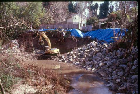
NRCS designed a 3m (10 ft) high riprap apron with a toe trench. Use of geotextile fabric was restricted to the key trench and approximately 1.8 m (6 ft) up the bank.
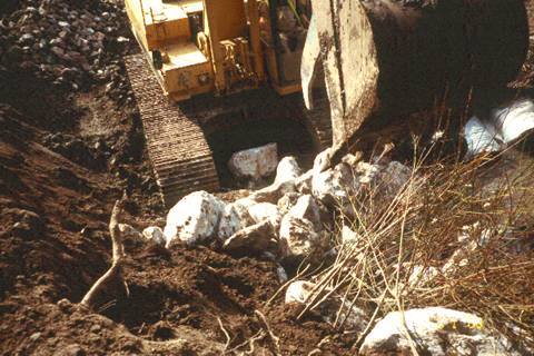
Traditional riprap installation was modified to incorporate live willow branches and willow poles, and ensure maximum contact with the soil embankment for increased establishment potential. Willow and cottonwood poles were incorporated beginning approximately 1 m (3 ft) above the mean low water level, with the basal ends of the poles below or near the perennial water table. The largest rocks were placed in the toe trench and locked tightly together. Willow poles and branches were then placed in the trench with their tips protruding out over the stream. More rocks were added, and periodically, the tops of the willow poles were bent up and out towards the stream, such that approximately 60 cm (24 in) of the terminal end was exposed to sunlight. During construction, the equipment operator was instructed to place soil fines behind and between the rocks, so that the willow cuttings would have maximum stem-to-soil contact.
Brushlayers were also installed during riprap construction, such that the basal ends were in the embankment, and the terminal buds were overhanging the creek. The first course of brushlayering was constructed 1 m (3 ft) up the slope, on an in-sloped bench. Sloping the bench into the embankment allowed the butt ends of the willows to angle down 10° to 30° below horizontal. The brushlayers were constructed in 3 to 6 m (10 to 20 ft) horizontal lengths along the entire project length. Branches were crisscrossed, and each layer was covered with at least 20 cm (8 in) of fill soil and compacted. This was repeated every 0.6 to 1.2 m (2 to 4 ft) up the slope 3 to 6 m (10 to 20 ft).
Two courses of vegetated gabions were constructed at the top of the downstream end of the vegetated riprap slope. The upper gabion was constructed on top of and slightly set back from the lower gabion. Live willow poles were placed through the baskets and "toe nailed" into the slope before the baskets were filled with rock.
Phase 2
Phase 2 of this project took place on the 18 m (60 ft) long, 6 m (10 ft) high upper slope of the upstream end of the project site. Two courses of vegetated gabions were installed as described just above the vegetated riprap that was installed during Phase 1 of the project. Above this, vegetated mechanically stabilized earth was installed to stabilize the slope.
The vegetated mechanically stabilized earth was installed by laying brushlayers as described above, and laying a length of geotextile fabric over the brushlayer. Topsoil was then placed on top of the fabric and compacted before the fabric laying over the tips of the brushlayers was brought over the compacted lift. Another brushlayer was placed, and this process was repeated to the top of the bank.
Photo Documentation:
 |
 |
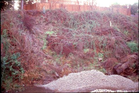
Before Construction, 1999 |
|
 |
 |
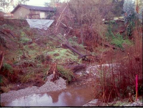
Before Construction, 1999 |
|
 |
 |
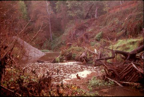
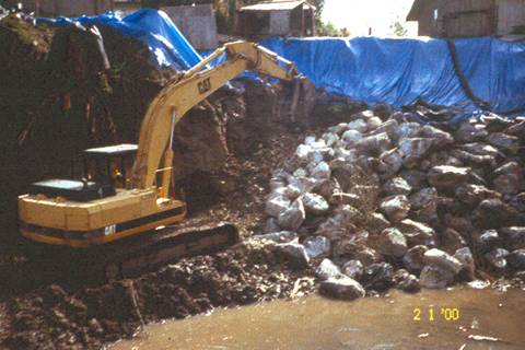
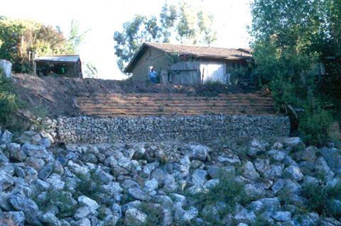
Phase 1, Early 2000 |
|
 |
 |
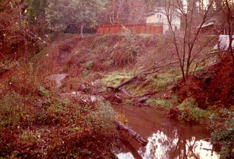
Phase 1, Early 2000 |
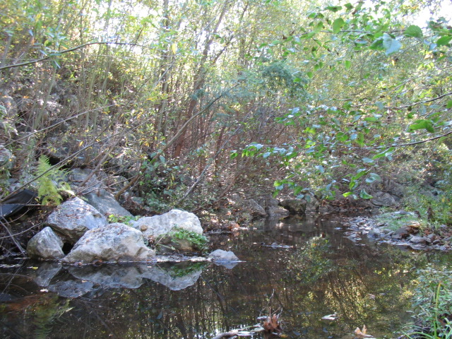
June 2000 |
 |
June 2000 |
 |
 |
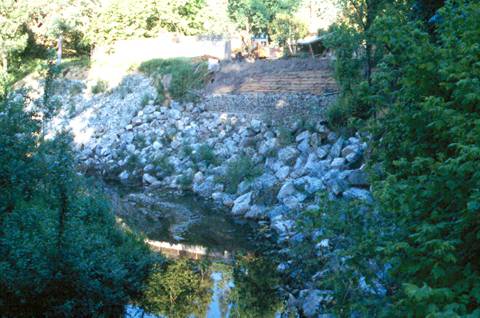
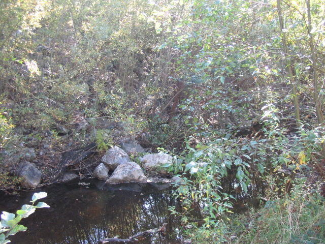
July 2002 |
|
 |
 |
July 2002 |
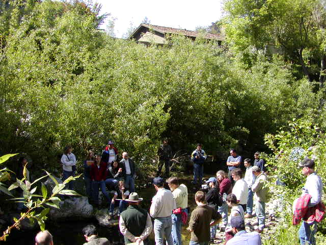
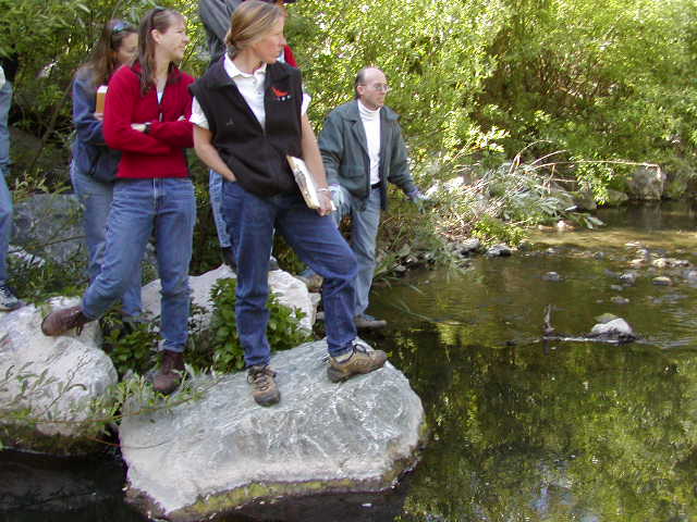
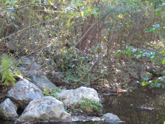
November 2004 |
 |
 |
November 2004 |
|